Category Archives: WA

Derby mud flats

The massive tidal changes in King Sound reveals extensive mud flats across the southern part of the Sound, around Derby.

Derby township itself is surrounded by mud flats which The Doc drove on several times (being careful not to break through the dried surface). These mud flats are not fully tidal every day, probably only on King tides. However, anytime The Doc felt the surface get soft he headed back to drier parts.

After taking off, in the helicopter, the first place we see is the big house, the Derby Prison. The Prison inmates look after the graves at the nearby Leper Colony, aka the old Bungarun Leprosarium, just north of Derby (Blog report here). The Doc drove up to Bungarun using the mud flats, not the road.

The mud flats reveal one of nature’s fractals, the repeating patterns you see when water is draining away on the mud flats (what The Doc calls the recurring tree pattern). To be precise “Fractals are infinitely complex patterns that are self-similar across different scales.” If you look carefully, you will see the same pattern repeating itself. Admittedly it is more obvious in the helicopter where you better appreciate the scale of these fractals.

There is endless variety in the mud flats, including their shapes, colour and textures. While they are many images, the total was culled hard to give a good cross section.

The Doc finds the mud flats fascinating. Enjoy.

The Buccaneer Archipelago, with a little of Yampi Sound thrown in

Below is a satellite image of Derby, King Sound (that great big “harbour”) and on its northern edge a group of Islands known as the Buccaneer Archipelago. The Derby mud flats are obvious on the southern edge of King Sound, near the Derby township. Towards the top right is the Walcott Inlet, which leads into Charnley River and its gorge, yesterdays spectacular post.

The helicopter trip continues. Here is small selection of images from the Buccaneer Archipelago. Wikipedia states “The archipelago, covering over 50 square kilometres (19 sq mi) is located at the head of King Sound and is composed of about 800 islands found between King Sound and Collier Bay near Yampi Sound.”

Yampi Sound also has a major Army training base inland from the Sound itself. The images towards the middle with a burn off taking place, from memory, is part of Yampi training grounds. Often Yampi is boring open grasslands. The Australian Wildlife Conservancy helps the Army conserve part of the training grounds set aside for conservation along the coast.

The massive tidal flows are obvious in several images, with the disturbed water during a tidal change.

To see a larger image click on a thumbnail.

Charnley River Gorge, Artesian Range, The Kimberley

When posting some Kimberley images recently The Doc realised he has not posted images from his 2-day helicopter trip out of Derby in 2015 (better late than never!) – except 2 or 3 images.

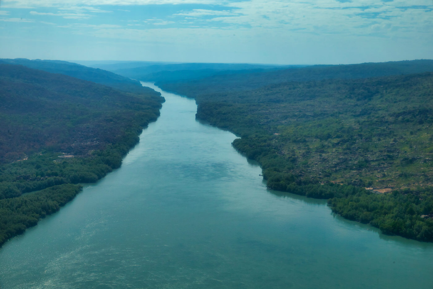
Starting with Day 2, here are images from flying along the Charnley River Gorge, Artesian Range, The Kimberley, Western Australia. It was a thrill of a lifetime, breathtakingly beautiful place. We had permission from Australian Wildlife Conservancy to do the trip over their property and land. With both the pilot and the passenger being AWC supporters helps!

The Artesian Range is the only part of Australia that has not suffered any mammal extinctions since European settlement, but the cane toads got into the area in the last few years. So that may change.

Where the river bed is a muddy light grey, the river is tidal. The clearer water is beyond the tidal zone and is fresh water coming down the river.

We landed and took pictures of Aboriginal art, which had some very rare figures. The Doc may post one or two later.

Make sure you click on the image to see the full size slide show.

Dead Dingo

Today we move from the Dashing Dingo to a dead one, roadkill in a remote part of the Kimberley. The Doc was saddened by this find, as the female dingo was heavily pregnant and probably killed by someone traveling fast along the road. With her enlarged nipples and stomach, the bitch was not long from giving birth to a litter. It was fresh kill, so the body was not bloated, just enlarged from the litter.

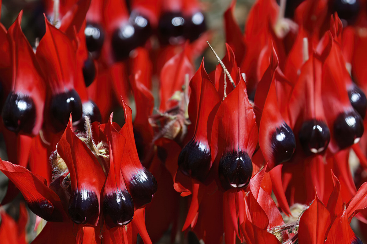
Stunning Sturt Desert Pea

Commonly known as the Sturt Desert Pea, floral emblem of South Australia. The dark eye version is from South Australia, the lighter coloured eye is the northern or WA form found in the Northern Territory and WA.

It is known by some other names as well including: Swainsona formosa, Showy Donia (G. Don 1832), Beautiful Donia (G. Don 1832), Dampier’s clianth (Veitch 1850), Dampier’s Clianthus (Hooker 1858), Sturt’s pea (Adelaide Advertiser 1858), Sturt pea (de Mole 1861), Captain Sturt’s desert pea (Aspinall 1862), Desert pea (Anon 1864), Sturt’s desert pea (Tenison-Woods 1865), Glory flower (Bailey 1883), Glory pea (Bailey 1883), Sturt’s glory pea (Anon 1886), Lobster claws (The Garden 1890), Blood flower (Parker 1898), Dampier’s glory pea (Guilfoyle 1911), Australian glory pea (Guilfoyle 1911), Dampier pea (Harris 1980).

The Northern Kimberley

While staying at Drysdale River Station The Doc took a plane flight into the Northern Kimberly. Initially through Prince Regent National Park, then up to Mitchell Falls and back again.

Sorry about the funny colour cast and soft images, it was caused by the window on the plane. The best flight in that area without the high price tag of the helicopter flights at Mitchell Falls itself.

The Bungle Bungles, Kimberley, WA

The Bungle Bungle Ranges in the Purnululu National Park (The Kimberley) has the most extensive beehive rock formations in the world. While well known to local Aboriginals and Cattle Station owners, it did not become known to the world until the early 1980s.

Within 5 years it was a National Park and within 20 years it was World Heritage listed.

The beehives are formed by wind driven sand and rainfall (plus millions of years of weathering).

The beehive domes consist of different layers of sandstone; some orange, some black. The black layers hold more moisture allowing cyanobacteria growth which cause the black colour. The orange-coloured layers are stained with iron and manganese mineral deposits within the sandstone (in lay terms – rust!).

Typically, you see the domes from ground level. The Doc took a helicopter flight over The Bungle Bungles. The images are split into two groups; first, the rock formations out of which the beehives are weathered. Here you see deep gorges, meandering rivers (floodways now) and steep gorge walls. Second the domes or beehives themselves, from the air. Make sure you click on the pictures to see the full size images.

The Doc has been posting fewer images lately, but the Bungles deserves more to appreciate its stunning beauty.

Gascoyne Region, WA

The Gascoyne Region in Western Australia was visited as part of the Kimberley/Pilbara trip in 2015. There are still many images The Doc has never posted, here are some more.

At the mouth of the Gascoyne River is the township of Carnarvon. NASA built a tracking station at Carnarvon to help with the Gemini and Apollo space missions. The tracking station is now gone but there is a major telecommunications hub still there. The Carnarvon tracking station was also used to track long range missiles from the RAAF Woomera Test Range launched from South Australia into the Indian Ocean over Carnarvon.

The Doc stayed in the Carnarvon caravan park for a week, touring around the region and having the Patrol serviced for the trip back across Australia.

The Doc drove a few hours up the river to the Kennedy Ranges National Park (and nearly came to grief crossing the Gascoyne River). The images are from this trip, plus a quick side trip to the Quobba blowholes near where HMAS Sydney was found off the coast. HMAS Sydney being sunk with all hands lost by a German raider, the Kormoran, disguised as a merchant ship.

Remember to click on the image to see the full size. Enjoy.

Video of the Quobba Blow Holes.

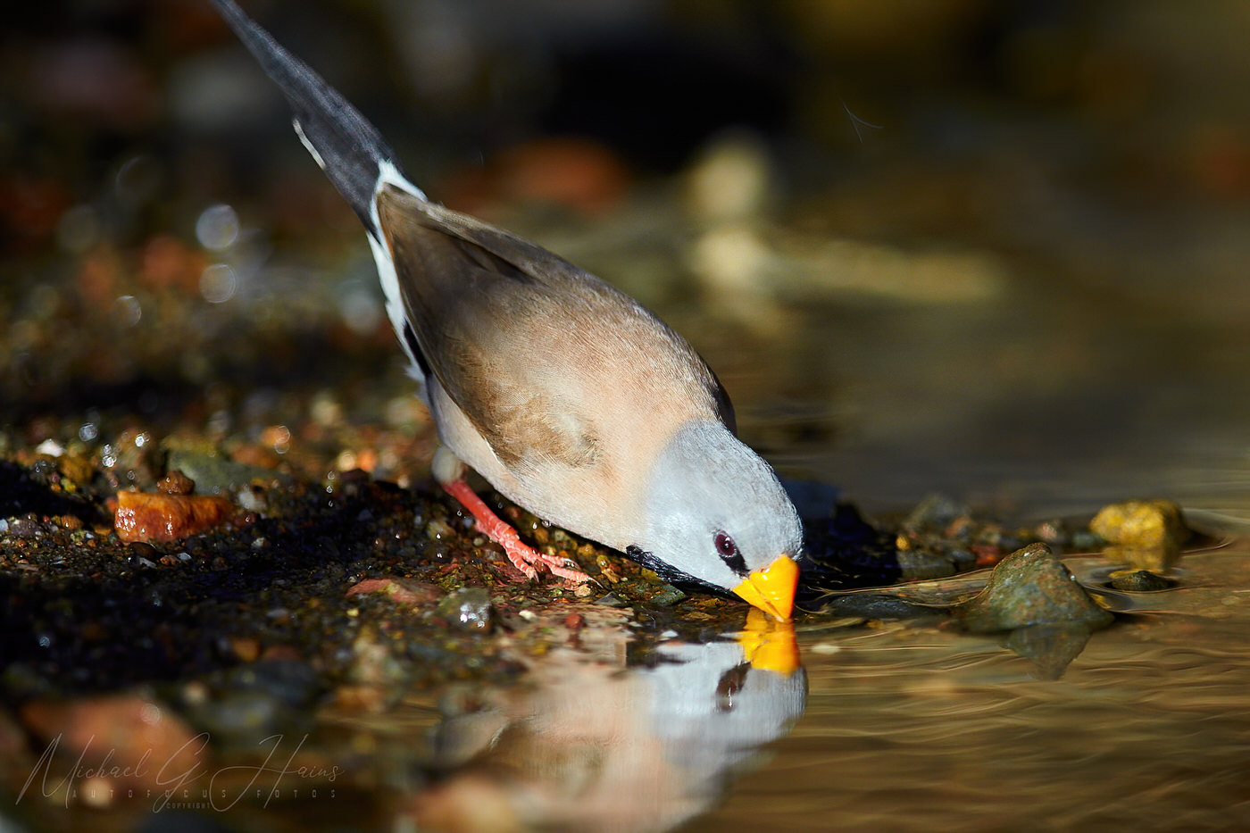
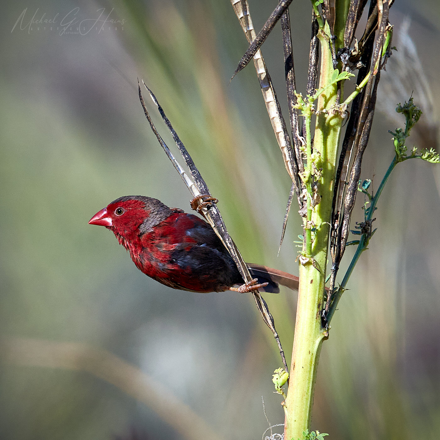
Crimson finch – blacked belly

The Doc could not travel to the Kimberly this year, so he is visiting images from his last trip in 2015. Here are the Crimson finch, the black bellied subspecies. Click on image to see full size.