Leaving from Port Douglas and ending on Haggerstone Island. The original Cape York images and reports are here.

Enjoy. Viva Cristo Rey.


Leaving from Port Douglas and ending on Haggerstone Island. The original Cape York images and reports are here.
Enjoy. Viva Cristo Rey.

Part 1 is located here.
Part 2 are images from a Pentax Medium Format camera, were the number of missed shots were lower on this camera than the Canon posted yesterday in Part 1. Every other time it was the reverse.
The Gulf of Carpentaria is an under explored part of Australia. Only this week AWC announced a new species of legless lizard, Lerista munuwajarlu, has been officially accepted after 10 years of the research.
Click on an image to see a slideshow at full size. Viva Cristo Rey.


Below is a satellite image of Derby, King Sound (that great big “harbour”) and on its northern edge a group of Islands known as the Buccaneer Archipelago. The Derby mud flats are obvious on the southern edge of King Sound, near the Derby township. Towards the top right is the Walcott Inlet, which leads into Charnley River and its gorge, yesterdays spectacular post.

The helicopter trip continues. Here is small selection of images from the Buccaneer Archipelago. Wikipedia states “The archipelago, covering over 50 square kilometres (19 sq mi) is located at the head of King Sound and is composed of about 800 islands found between King Sound and Collier Bay near Yampi Sound.”
Yampi Sound also has a major Army training base inland from the Sound itself. The images towards the middle with a burn off taking place, from memory, is part of Yampi training grounds. Often Yampi is boring open grasslands. The Australian Wildlife Conservancy helps the Army conserve part of the training grounds set aside for conservation along the coast.
The massive tidal flows are obvious in several images, with the disturbed water during a tidal change.
To see a larger image click on a thumbnail.


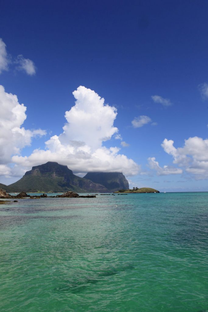
Enjoy this unusual view of LHI.


Some panoramas from Lord Howe Island. Click on image to see full size panorama.


A few images from the boat trip from Lord Howe Island to Ball’s Pyramid.
Ball’s Pyramid is the largest single rock stack in the world. It is where the Lord Howe Island stick insect survived after being wiped out by rats on Lord Howe (only rediscovered in the the 1970s).
The birds are mostly Providence petrels. Enjoy.


The Doc is stuck at home in a lockdown, but on virtual tour through some images. This one from Coffs Harbour with a storm over head.

The Doc revisited his Cape York images – the 4 Day Helicopter trip around Cape York that is. Bungie was the copter pilot. Enjoy.


The Doc has wanted to visit and photograph the sandstone here for some time, with no success (one or two failed attempts). So he booked 2 nights at Copcabana this week to visit and take photographs.
Here, the sandstone made up of tessellated pavement and Liesegang rings. They do not fully understand how these rings occur, but they do occur in sedimentary rock with a cross cut pattern. Iron and other minerals must be present creating the patterns. The is a heavy iron layer in this rock, you can see iron oxide or rust layers when the iron is exposed to water and oxygen.
Technically “there is a precipitation process that is thought to be the catalyst for Liesegang ring formation referred to as the Ostwald-Liesegang supersaturation-nucleation-depletion cycle.” OK?
A small selection of the spectacular sandstone.


Putty Beach also has a nice rock platform with some large waves. This place must be spectacle in heavy surf, as it was great with minimal waves. Enjoy.


Another tree from Cocos Islands, the Sea Almond. A rare treat indeed, a tropical plant that is deciduous.

You must be logged in to post a comment.