Category Archives: river/creeks

Bullo River Station: slight change of plans


There was rain overnight at Bullo River Station, so planes cannot land on the unsealed air strip. Guests are leaving earlier from Darwin and being taken to a nearby air strip – that would be a country “nearby”. Kununurra has the nearest sealed airstrip.

Then Guests have a 3 hour drive into Bullo River Station, which has the longest driveway in the Northern Territory. The driveway is the hard left off the Victoria Highway on the map below. All part of the adventure, for me. Plus The Doc knows how to drive into Bullo River Station in the Grenadier!

AWC just works around the challenges to get us there. Thank you AWC.

Derby helicopter trip – medium format style

The Doc also took his Pentax medium format camera on the helicopter. A selection of a few images from that camera are below.

The original images are massive in size (around 250 megs), and have stunning details even when heavily cropped. Not an easy camera to use in a helicopter because of its size and its slow autofocus. Plus you do not want to take too many images with large file sizes, which are slow and hard to work with. But the images, when they work out, are just gorgeous.

Click on an image to see the slideshow. It is worth it. Enjoy.

Plus some assorted images from Yampi Sound Training Ground, Charnley River Gorge up in The Artesian Range and the Buccaneer Archipelago.

Charnley River Gorge, Artesian Range, The Kimberley

When posting some Kimberley images recently The Doc realised he has not posted images from his 2-day helicopter trip out of Derby in 2015 (better late than never!) – except 2 or 3 images.

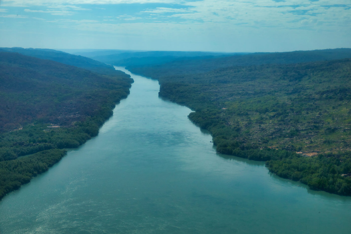
Starting with Day 2, here are images from flying along the Charnley River Gorge, Artesian Range, The Kimberley, Western Australia. It was a thrill of a lifetime, breathtakingly beautiful place. We had permission from Australian Wildlife Conservancy to do the trip over their property and land. With both the pilot and the passenger being AWC supporters helps!

The Artesian Range is the only part of Australia that has not suffered any mammal extinctions since European settlement, but the cane toads got into the area in the last few years. So that may change.

Where the river bed is a muddy light grey, the river is tidal. The clearer water is beyond the tidal zone and is fresh water coming down the river.

We landed and took pictures of Aboriginal art, which had some very rare figures. The Doc may post one or two later.

Make sure you click on the image to see the full size slide show.

Greens are not always green

The other revelation of the colour palettes has been leaves green leaves using transmitted light. We normally look at leaves in reflected light, but transmitted light is when the light source shines through the leaf. Your reaction is to think they are just shades of green, but they are much more complex than that.

On my walk yesterday The Doc picked up some eucalyptus leaves which he identified as Eucalyptus baueriana, or Blue Box. The Doc found an immature leaf and a mature leaf and photographed both.

Here is the immature leaf, a fairly consistent green.

Juvenile leaves disjunct, orbiculate, dull green.

The palette reveals it is more complex 154 core colours!

The mature leaf has core colour palette with 254 colours, 100 more!

The Doc then took both images and looked at the combined colour palette from both, it was 242 colours. While there is an overlap in the colours, the various palettes demonstrate that the leaf over it life varies in colour. More than what we first think. The Doc noticed this in barks as well and it is obvious over the life of flower.

The Northern Kimberley

While staying at Drysdale River Station The Doc took a plane flight into the Northern Kimberly. Initially through Prince Regent National Park, then up to Mitchell Falls and back again.

Sorry about the funny colour cast and soft images, it was caused by the window on the plane. The best flight in that area without the high price tag of the helicopter flights at Mitchell Falls itself.

The Bungle Bungles, Kimberley, WA

The Bungle Bungle Ranges in the Purnululu National Park (The Kimberley) has the most extensive beehive rock formations in the world. While well known to local Aboriginals and Cattle Station owners, it did not become known to the world until the early 1980s.

Within 5 years it was a National Park and within 20 years it was World Heritage listed.

The beehives are formed by wind driven sand and rainfall (plus millions of years of weathering).

The beehive domes consist of different layers of sandstone; some orange, some black. The black layers hold more moisture allowing cyanobacteria growth which cause the black colour. The orange-coloured layers are stained with iron and manganese mineral deposits within the sandstone (in lay terms – rust!).

Typically, you see the domes from ground level. The Doc took a helicopter flight over The Bungle Bungles. The images are split into two groups; first, the rock formations out of which the beehives are weathered. Here you see deep gorges, meandering rivers (floodways now) and steep gorge walls. Second the domes or beehives themselves, from the air. Make sure you click on the pictures to see the full size images.

The Doc has been posting fewer images lately, but the Bungles deserves more to appreciate its stunning beauty.

Gascoyne Region, WA

The Gascoyne Region in Western Australia was visited as part of the Kimberley/Pilbara trip in 2015. There are still many images The Doc has never posted, here are some more.

At the mouth of the Gascoyne River is the township of Carnarvon. NASA built a tracking station at Carnarvon to help with the Gemini and Apollo space missions. The tracking station is now gone but there is a major telecommunications hub still there. The Carnarvon tracking station was also used to track long range missiles from the RAAF Woomera Test Range launched from South Australia into the Indian Ocean over Carnarvon.

The Doc stayed in the Carnarvon caravan park for a week, touring around the region and having the Patrol serviced for the trip back across Australia.

The Doc drove a few hours up the river to the Kennedy Ranges National Park (and nearly came to grief crossing the Gascoyne River). The images are from this trip, plus a quick side trip to the Quobba blowholes near where HMAS Sydney was found off the coast. HMAS Sydney being sunk with all hands lost by a German raider, the Kormoran, disguised as a merchant ship.

Remember to click on the image to see the full size. Enjoy.

Video of the Quobba Blow Holes.