Tony enjoyed his time at Arkaroola Wildness Sanctuary in the Flinders Ranges in South Australia. We dined at the restaurant at night, went on the world-renowned Ridgetop Tour to Sillars Lookout (with Lamingtons, tea and a hair raising 3-point turn at the Lookout), observed the stars in the Observatory (there are 4 at Arkaroola) and even took a plane flight over Arkaroola and Lake Frome.
On the Ridgetop Tour Tony got to sit in the passenger seat upfront, the rest of us bounced around in the back!
We visited a few abandoned copper mines – the Ridgetop Tour track was made when mining companies where looking for uranium in earlier times. The Flinders Ranges generally and Arkaroola in particular is one the most beautiful places in Australia and it is geologically unique in the world.
Arkaroola and the nearby Brachina Gorge are also home to the endangered Yellow-footed Rock Wallaby, Australia’s most beautiful macropod (kangaroo or wallaby). Pictures of Arkaroola and the Yellow-footed Rock Wallaby can be viewed here.
In 2014 Tony and I travelled around outback NSW, Queensland and South Australia. Places like the Warrumbungles, Broken Hill, Marree, the ochre pits at Lyndhurst, ruins at Farina, Arkaroola Wildness Sanctuary, Innamincka, Brachina Gorge in the Flinders Ranges, Epsilon in outback Queensland, Cameron’s Corner, Tibooburra, Menindee Lakes and lots of others.
Characters like Talc Alf, roadtrains and huge coal carrying locomotives, the odd emu and even some water in this parched part of Australia.
Tony had a long chat with Talc Alf and enjoyed his stories (Alf was also the Outback postmen, talc carver, talc miner and general dogs’ body!).
Here is a map of the trip. The kink over Lake Frome near Arkaroola in SA was a plane flight we both took around Arkaroola. Doug Sprigg was the pilot and he thanked us all for financing his hobby (flying) when we returned. Lake Frome is the whitest salt lake in the world and is used by NASA to make various measurements.
Tony often spoke about the trip. He had photos on his phone he would show to nurses on his many trips to hospital. Tony is in five images below and I have written a little story around each one.
Coffee at the Innamincka Pub in SA
We had a shower at the public shower block – after being so remote for a few days a shower felt amazing.
Tony is drinking coffee before lunch. Then on to juicy steak sandwiches, chips and salad in the dining area. Then cake and ice cream for desert. The food was superb. The Innamincka Pub at the time was owned by the same people who owned the Birdsville Pub, Innamincka had better food IMO.
Tony also retained fond memories of the Innamincka Pub. We talked about it for years after.
Canonba near Nyngan Outback NSW
Tony sitting beside the car near his tent around 6.30am. My bed is in the Patrol.
We had refuelled and resupplied at Nygnan the previous afternoon and drove out to the free camping ground at Canonba. It was on the Canonba Road about 10kms out of the Nygnan township. Close by us in the camping ground was a wandering drover with his dogs (hidden by the Patrol).
Canonba was once an important Outback town when it was a supply depot for Cobb & Co coaches. Once the railway went through Nygnan, Canonba disappeared.
Middle of nowhere
Tony with the trailer gate down boiling the billy for tea. We had camped overnight in the middle of nowhere. The driver was tied. We camped beside the Wool Track between Ivanhoe and Cobar, NSW. It was an access road to the surrounding stations and not a single car drove past the whole time we were there.
Coally Station, Far North West NSW
Tony is leaning on the passenger’s seat setting up his camera. This was at a small ephemeral wetland off the Silver City Highway near Coally Station Homestead.
Earlier we had driven through Cameron’s Corner (fancy hamburgers for lunch that time, yum), then through Stuart National Park in the far north eastern corner of NSW.
Epsilon Station, Outback Qld
The image with Tony standing at the car door looking forward was near Epsilon Station in remote Outback Queensland. We were travelling out of the area on private roads used to service the Moomba Gas Field oil wells. Earlier we saw the white camel also pictured.
The road is called the Nappa Merrie-Santos Road. We were on the Santos end, Nappa Merrie Station (Ranch for any American readers) being at the other end. In remote Australia it is common to name roads after the destinations at each end, it sure helps you know where you are going.
How do I remember these details? First, I add keyword to my images. Second, I keep a travel diary to help indexing. Last, I add GPS co-ordinates to the images. Here I mainly used the GPS co-ordinates and memory.
Due to some medical issues with Tony (bruising mostly) the trip lasted only two weeks instead of the planned three weeks. Due to Tony’s limited mobility I was visiting places where I could drive Tony close to the scenery or eating place. It worked out well. I still remember those delicious BLTs (bacon, lettuce and tomato sandwiches) at the Blenheim Pub, Flinders Ranges. SA.
Click on the first image and a slideshow will appear. Take five minutes to look through the images.
The Doc had to replace the Patrol’s auxiliary battery charger, with a new Redarc 1225D which has a solar panel input. The Doc purchased a 100w Giant Solar panel (which uses A grade solar cells) and installed it himself on the roof rack, allowing space for the recovery tracks, jerry can and second spare tyre.
The wiring goes along the bottom of the roof rack to the gutter. The wiring then goes down the gutter behind the snorkel (visible on the right), through some body work just in front of the windscreen into the engine bay and plugs into the Redarc 1225D.
The panel is secured by six M10 eye bolts to the roof rack (five are visible in the image below). Six M12 bolts fix the panel to the brackets. The brackets are 4mm thick. The roof rack should come off before the panel ever does!
The panel has been working well and keeping the auxiliary battery topped up, with power to spare. The Doc has been using this extra power to charge various household batteries in the Patrol.
The Doc is now testing battery monitors with their iPhone & Android Apps to get real time data on battery condition. The Patrol’s Autron voltage gauges only work when the car is turned on. It is part of an ongoing project to extend battery life of the Patrol’s starter and auxiliary batteries. EDIT: battery monitor review is here.
It took some time but The Doc has finished his Guide on the West MacDonnell Ranges. The Guide starts and finishes at Alice Springs in the Northern Territory. The Guide is here.
You can then do the East MacDonnell Ranges, that Guide is here.
The Guide on the West MacDonnell Ranges has detailed maps, location
notes and images. The number of images meant The Doc had to use high
compression and so there are some artefacts in some images. It is a very detailed
Guide. You could easily spend 2 or 3 weeks doing the West MacDonnell Ranges and
another week doing the East MacDonnell Ranges.
Digging deep into the The Doc’s secret archives comes a variety of images of Australia’s most beautiful macropod, the Yellow-footed Rock Wallaby. The Doc has posted a few in the past, but none of these images.
The Doc had a very good response to the last sets images. So
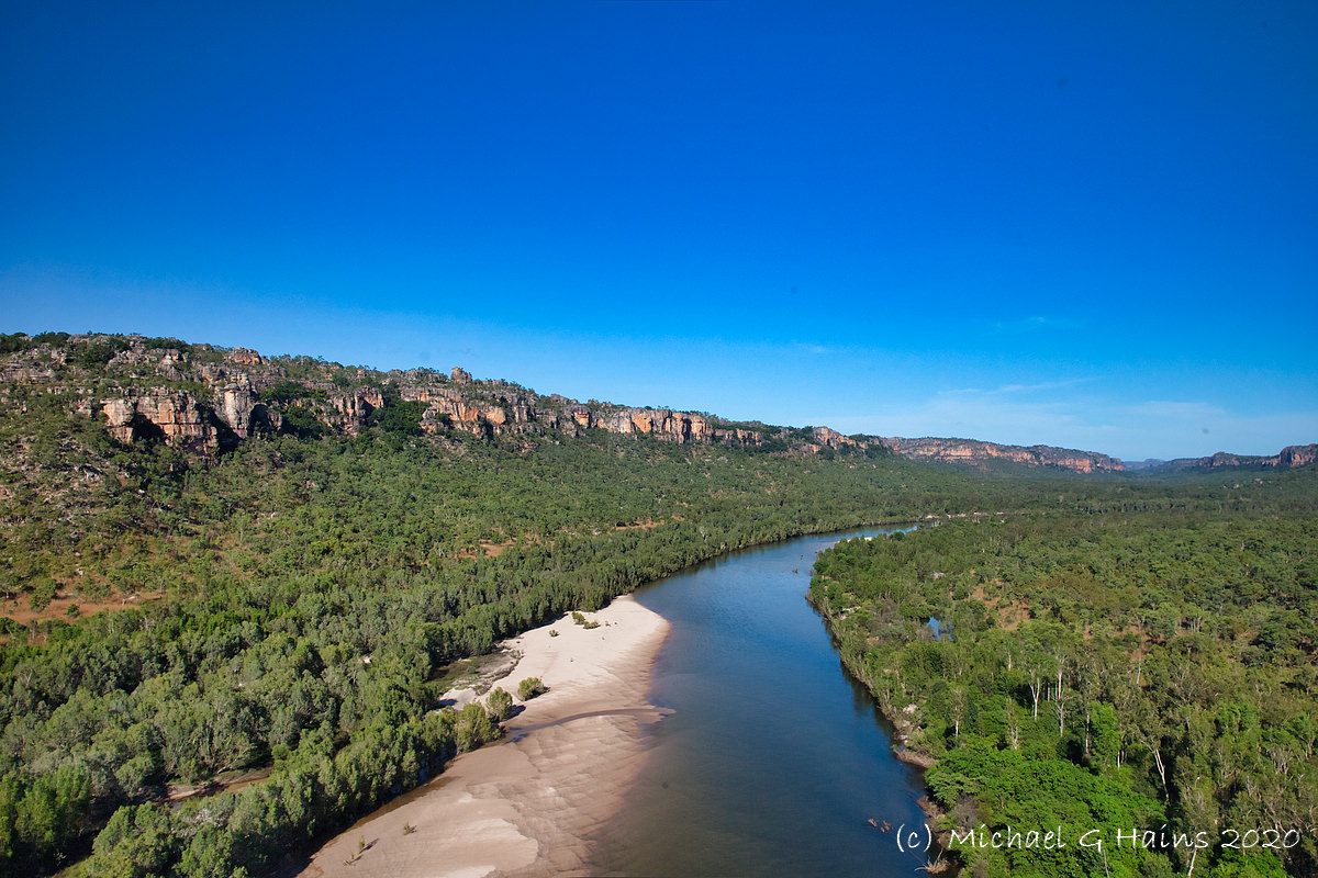
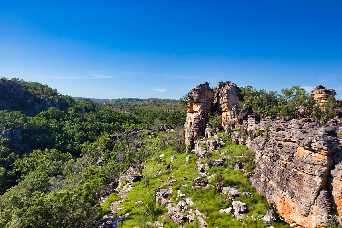
he reviewed more photos from his 4 day helicopter trip around Kakadu and Arnhem
Land in the Northern Territory. It has been almost 3 years since that trip but
the images bring back wonderful memories.
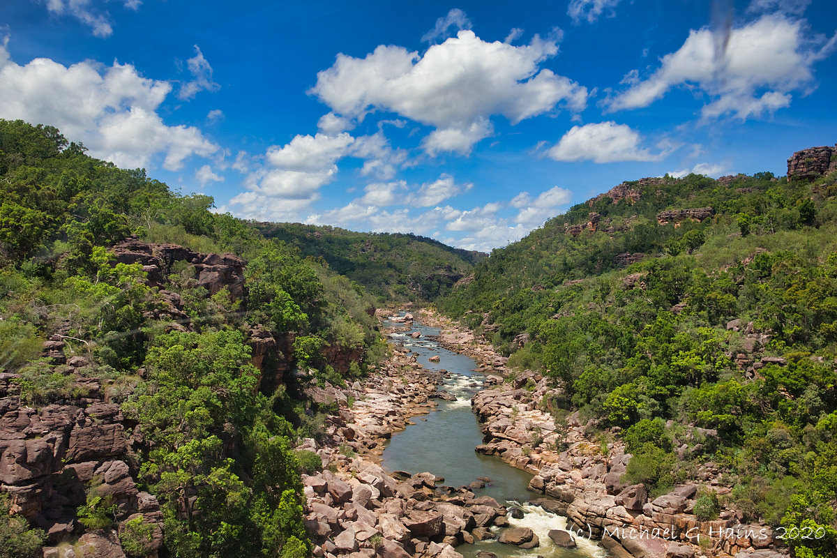
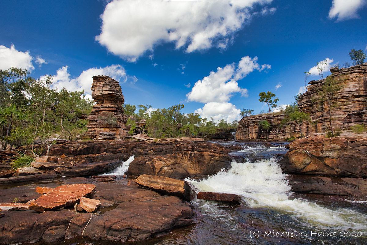
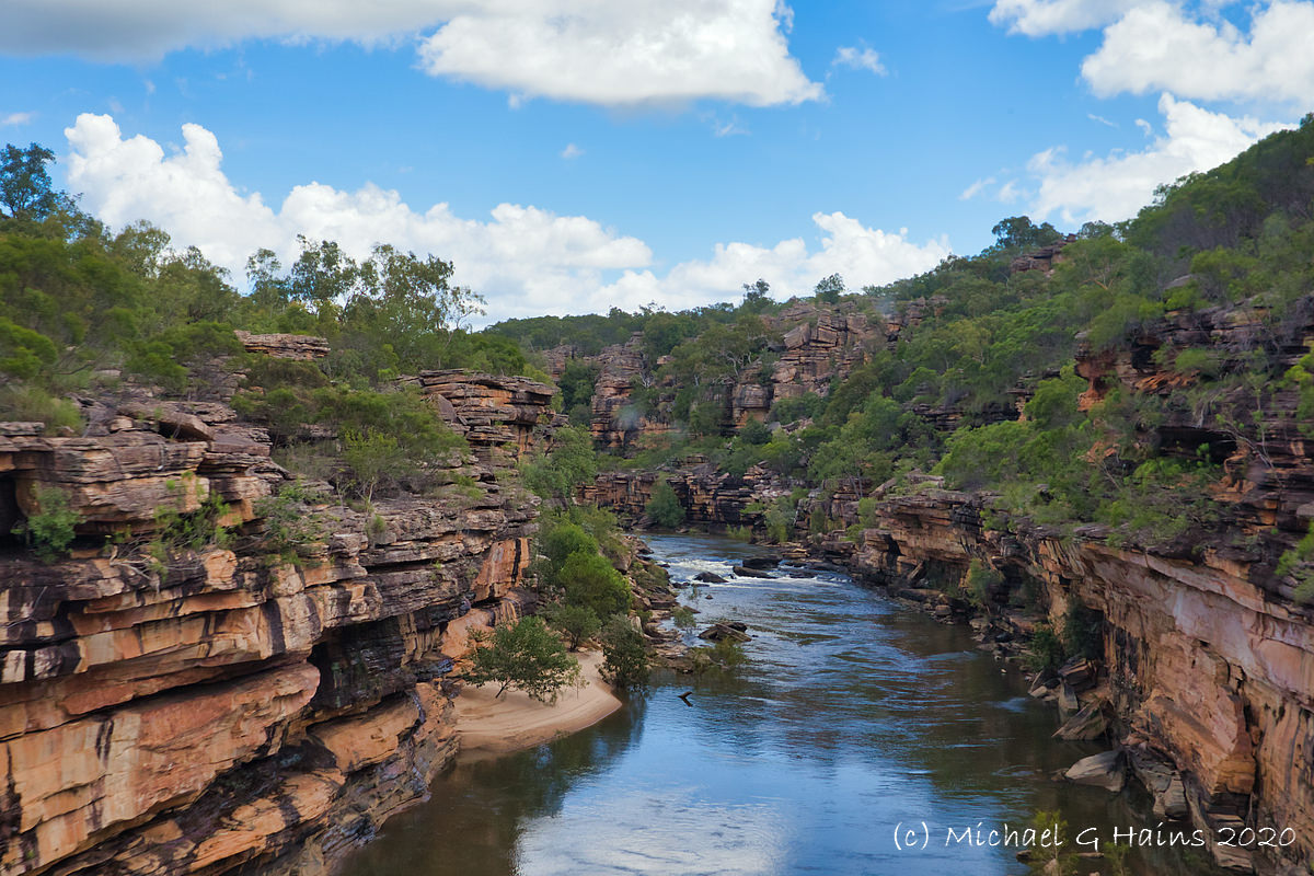
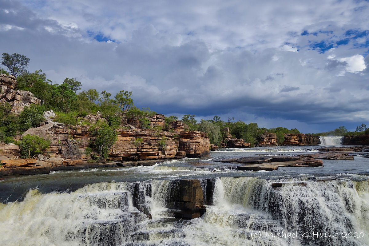
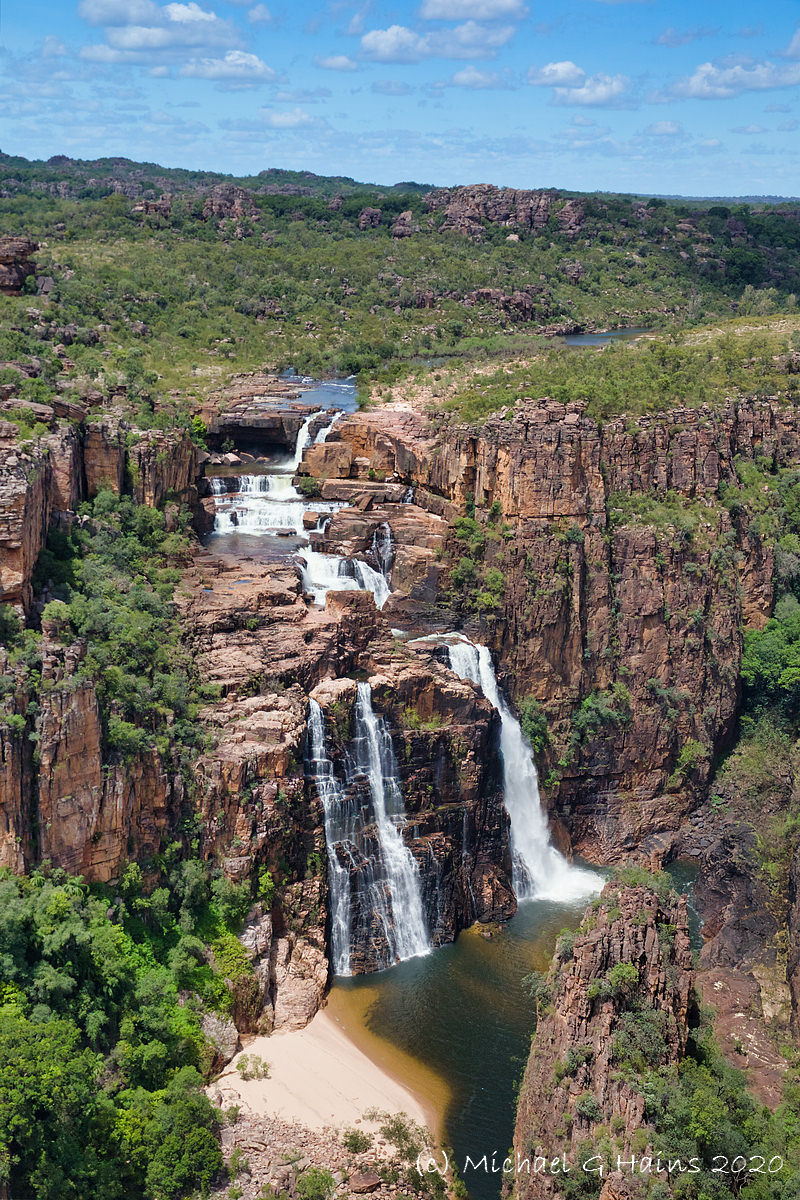
The theme this time is waterfalls, some famous like Jim Jim
Falls and others nameless. All with good water flow after the wet season.
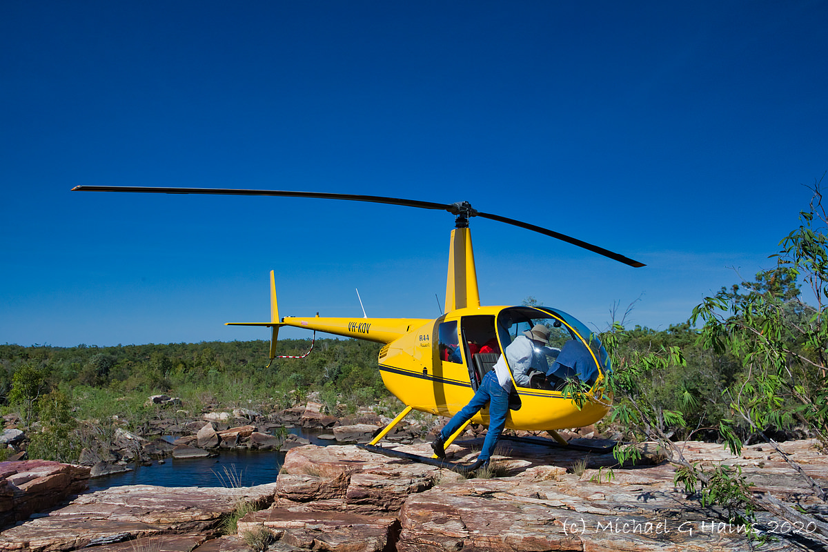
A second instalment on gorges and rivers will follow. Nick, the helicopter pilot, is in one of the images. The next set of images will have the trusty steed, the Robinson R44 helicopter!
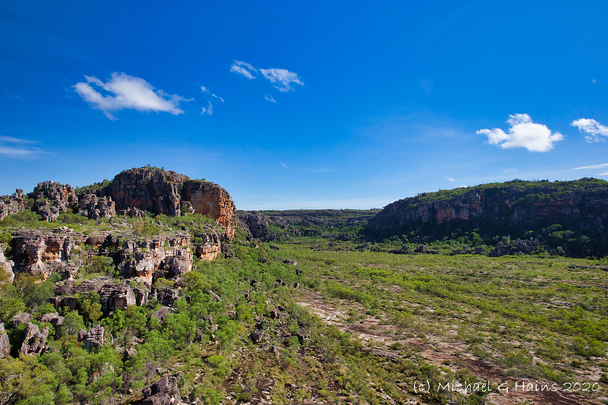
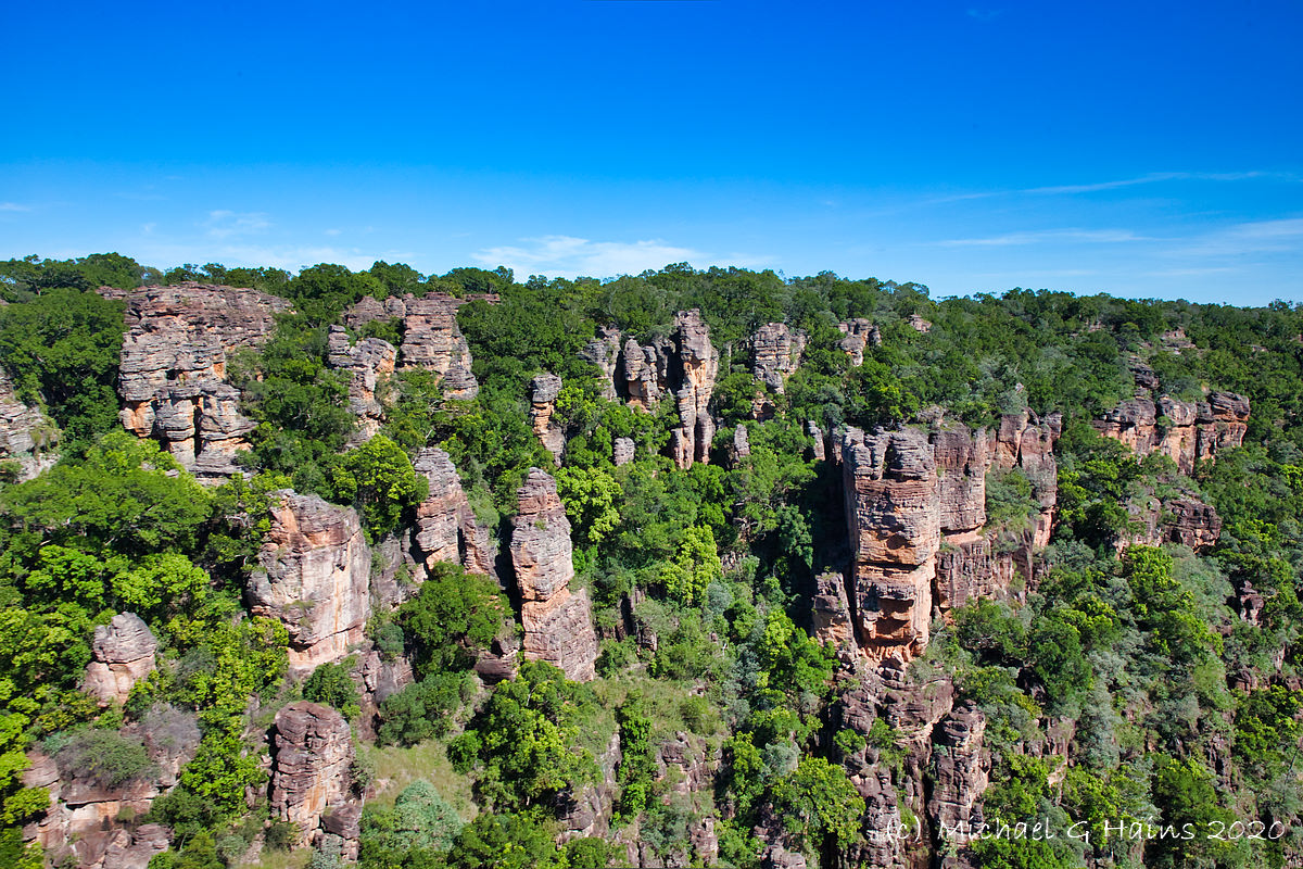
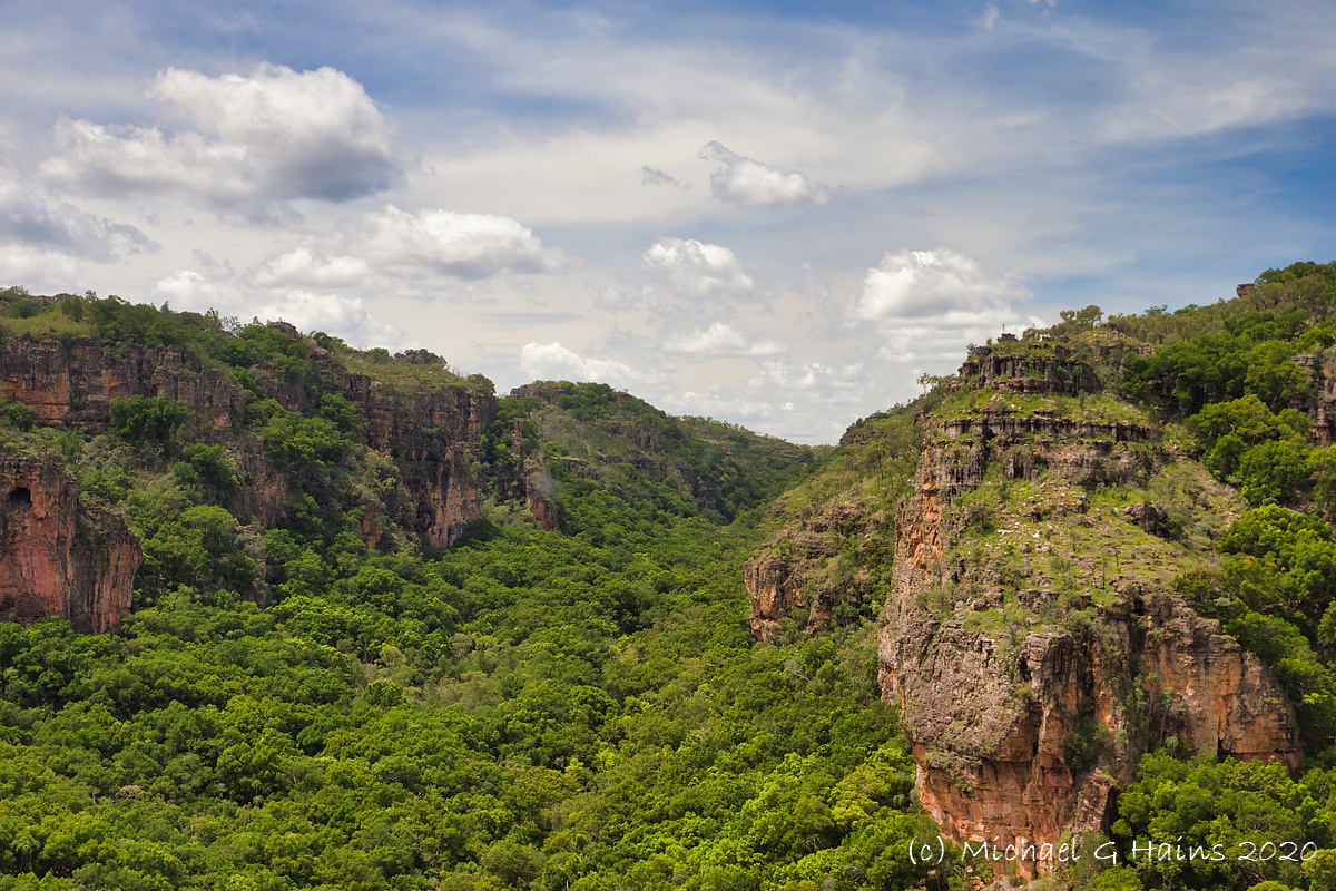
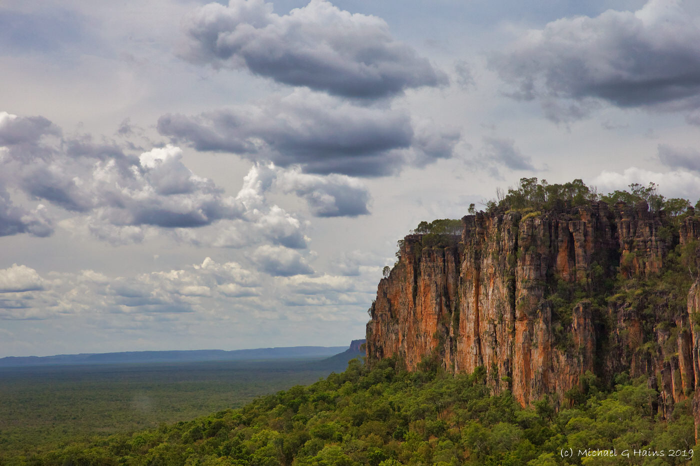
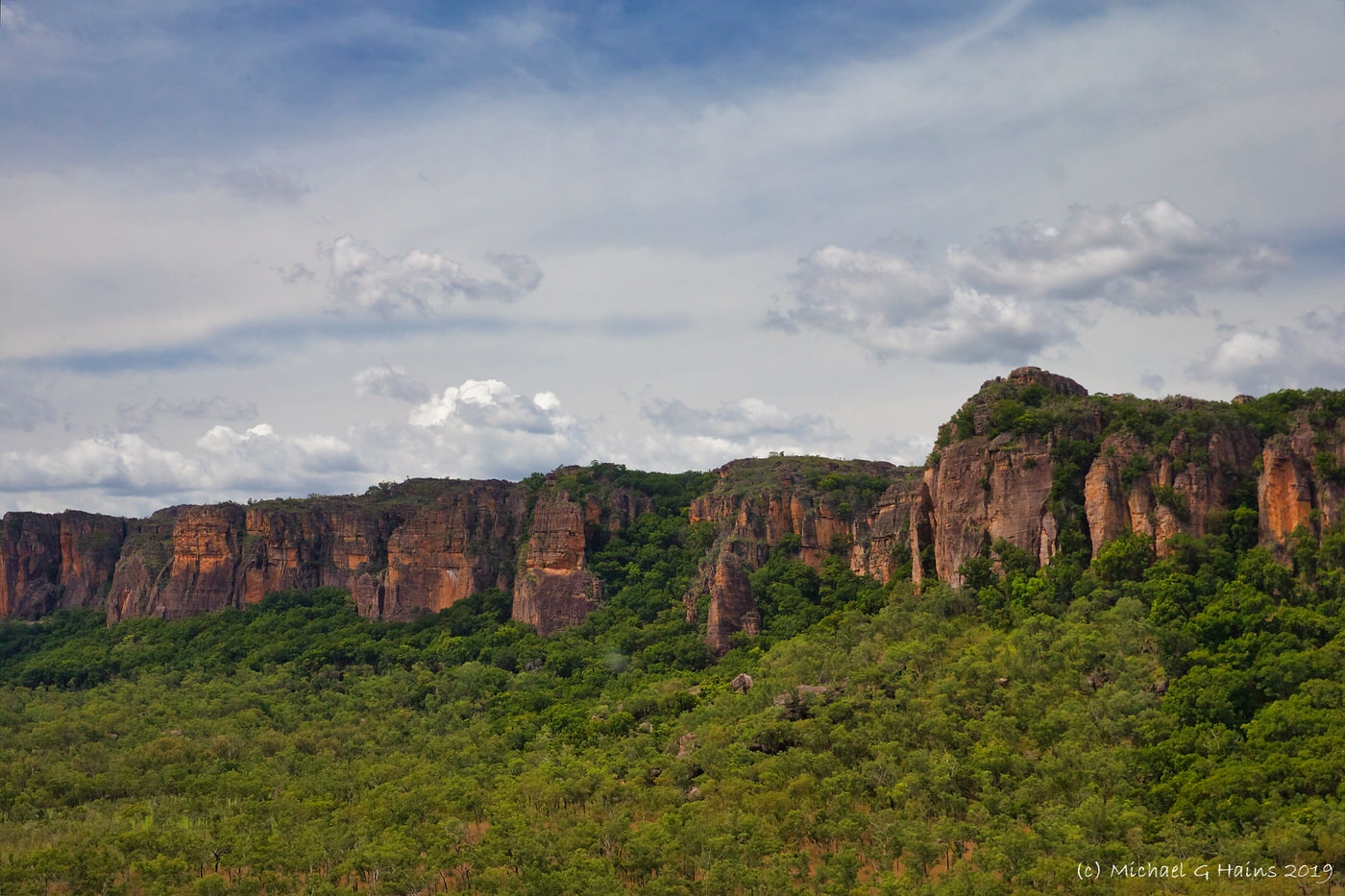
There is a massive escarpment in Arnhem Land that divides most of Arnhem Land up on the plateau from the smaller coastal part. Jim Jim Falls and Twin Falls are examples of water flowing off the escarpment in Kakadu National Park. It is rarely shown.
During my helicopter trip over Arnhem Land and Kakadu I flew along the escarpment. Here are some images, the escapement is HUGE (especially in a helicopter about 100m away.)


You must be logged in to post a comment.