May the peace of the Christ child be with you and your family this Christmas.

May the peace of the Christ child be with you and your family this Christmas.
The real reason for CHRISTmas.
This image was censored by Facebook in 2018 as “violent or graphic content.” I kid you not. Facebook only removed the warning after the story went viral and its outrageous censorship became a matter of public knowledge.


The Bungle Bungle Ranges in the Purnululu National Park (The Kimberley) has the most extensive beehive rock formations in the world. While well known to local Aboriginals and Cattle Station owners, it did not become known to the world until the early 1980s.
Within 5 years it was a National Park and within 20 years it was World Heritage listed.
The beehives are formed by wind driven sand and rainfall (plus millions of years of weathering).
The beehive domes consist of different layers of sandstone; some orange, some black. The black layers hold more moisture allowing cyanobacteria growth which cause the black colour. The orange-coloured layers are stained with iron and manganese mineral deposits within the sandstone (in lay terms – rust!).
Typically, you see the domes from ground level. The Doc took a helicopter flight over The Bungle Bungles. The images are split into two groups; first, the rock formations out of which the beehives are weathered. Here you see deep gorges, meandering rivers (floodways now) and steep gorge walls. Second the domes or beehives themselves, from the air. Make sure you click on the pictures to see the full size images.


The Doc has been posting fewer images lately, but the Bungles deserves more to appreciate its stunning beauty.


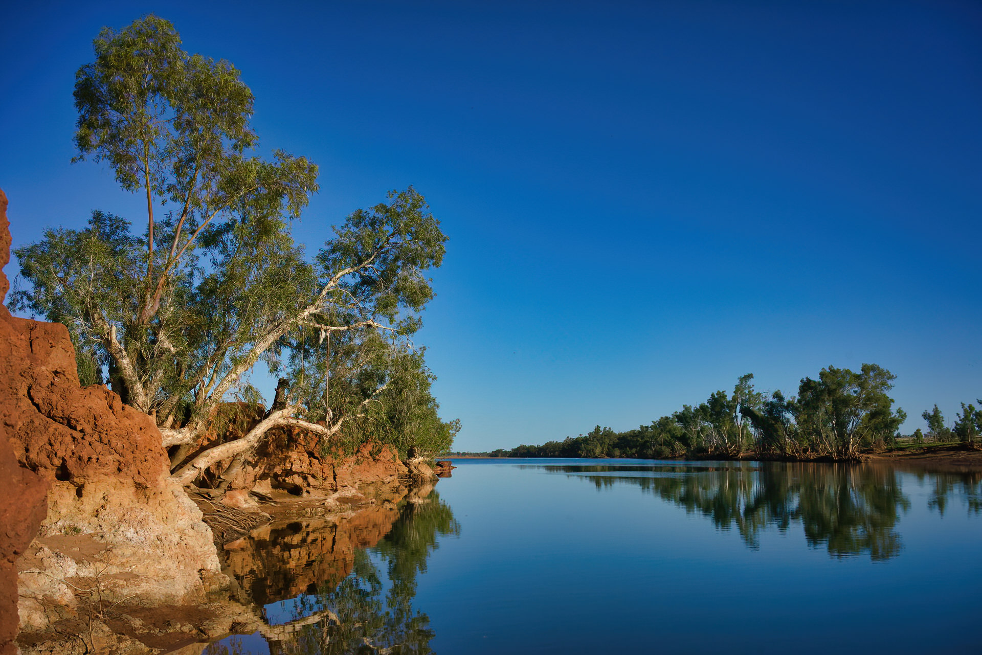
The Gascoyne Region in Western Australia was visited as part of the Kimberley/Pilbara trip in 2015. There are still many images The Doc has never posted, here are some more.
At the mouth of the Gascoyne River is the township of Carnarvon. NASA built a tracking station at Carnarvon to help with the Gemini and Apollo space missions. The tracking station is now gone but there is a major telecommunications hub still there. The Carnarvon tracking station was also used to track long range missiles from the RAAF Woomera Test Range launched from South Australia into the Indian Ocean over Carnarvon.
The Doc stayed in the Carnarvon caravan park for a week, touring around the region and having the Patrol serviced for the trip back across Australia.
The Doc drove a few hours up the river to the Kennedy Ranges National Park (and nearly came to grief crossing the Gascoyne River). The images are from this trip, plus a quick side trip to the Quobba blowholes near where HMAS Sydney was found off the coast. HMAS Sydney being sunk with all hands lost by a German raider, the Kormoran, disguised as a merchant ship.
Remember to click on the image to see the full size. Enjoy.


Video of the Quobba Blow Holes.
You must be logged in to post a comment.