The Doc reprocessed some images from his first visit to AWC’s Mornington Sanctuary in 2014. It was a Supporter’s Event and it was the second Sanctuary he ever visited. The first was Scotia.
Late lift off on the last day due to rain at Weipa. We were going to land at AWC’s Piccaninny Plains Sanctuary to visit, but the late departure ruled that out.
We fly out of a wet Weipa over Coen, Yarraden and Piccaninny Plains all in the Cook Shire.
Then Lakefield (a really large area) and the Cape York Developmental Road until we reach Mount Carbine close to AWC’S Brooklyn Sanctuary. We land to refuel at Pennyweight Outstation, located on Brooklyn.
After refueling we headed back over Mareeba, where Bungie the Pilot lives and we fly over his helipad and then back to Port Douglas.
This morning we leave Haggerstone Island, then see downed aircraft, crocs up and close, Captain Billy Goat Waterfall and finally we land near a WW2 wreck of a P39 Aircobra which crashed on its way to Papua New Guinea. Flying up the coast we see bauxite deposits, sands, rivers and finally hover over the tip of Australia. Then an aerial trip around the Torres Strait, we did not land as you can wait for hours before customs turn up (they work on Island time). Last stop Punsand Bay Campgrounds to stay.
In Part 2 the images are from the surrounding Flinders Ranges, rather than Lake Froome. You get to see the extraordinary variety of rock formations of different colours and textures.
On average the images were taken from 270 to 380 metres in the air. The GPS Datalogger also gives you altitude.
Enjoy, Viva Cristo Rey. Click on an image to see the slideshow of images at full resolution.
When Tony Stott and The Doc went on an adventure to the Flinders Ranges we visited Arkaroola Wilderness Sanctuary. One of the owners Doug Sprigg, loves to fly so we went on a flight over Lake Froome and the Flinders Ranges.
The Flinders Ranges is one of the most geologically unique places in the world. Geologists from all around the globe visit. There is an extraordinary variety of rocks twisted and bent by tectonic forces under the earth. For example, while driving in Brachina Gorge you drove over something like 700 million years of rock layers, that have been bent from the horizontal to the vertical.
One of The Doc’s favorite places to visit. Further south you have Wilpena Pound. Now back to the flight.
Tony had one camera (a Canon 5DII) and The Doc two (Canon 1DX and a Pentax 645Z), We sat on opposite sides of the plane to maximize our opportunities. When processing the images it became clear Tony often had the better side, as The Doc was often photographing into the sun. Together we got a nice mix of images.
Part 1 is below with the flight going out over Lake Froome. Lucky for us the Lake had some water still giving us extraordinary colours and textures. Lake Froome is apparently the whitest salt lake in the world and used by NASA to take various measurements.
Part 2 are images from a Pentax Medium Format camera, were the number of missed shots were lower on this camera than the Canon posted yesterday in Part 1. Every other time it was the reverse.
The Gulf of Carpentaria is an under explored part of Australia. Only this week AWC announced a new species of legless lizard, Lerista munuwajarlu, has been officially accepted after 10 years of the research.
Click on an image to see a slideshow at full size. Viva Cristo Rey.
Next The Doc jumped into a helicopter and had a short flight over the Bungles. You take off and 30 seconds later you are over the bee hives and from this perspective you begin to understand how the “bee hive” formations were eroded from the surrounding plateau. In fact, the Bungles are still slowly being formed today. Viva Cristo Rey.
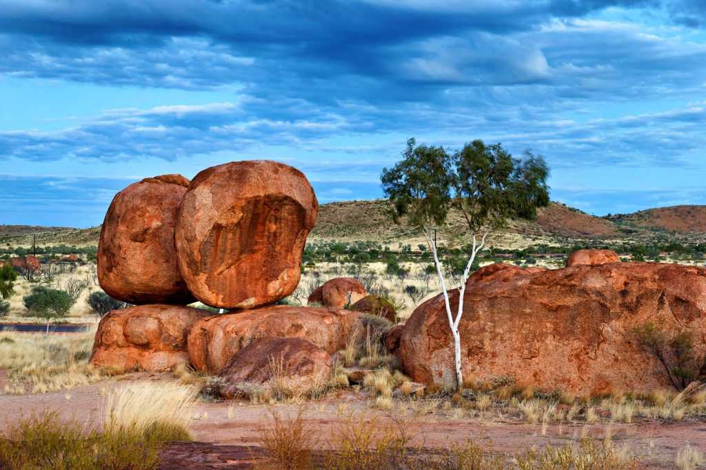
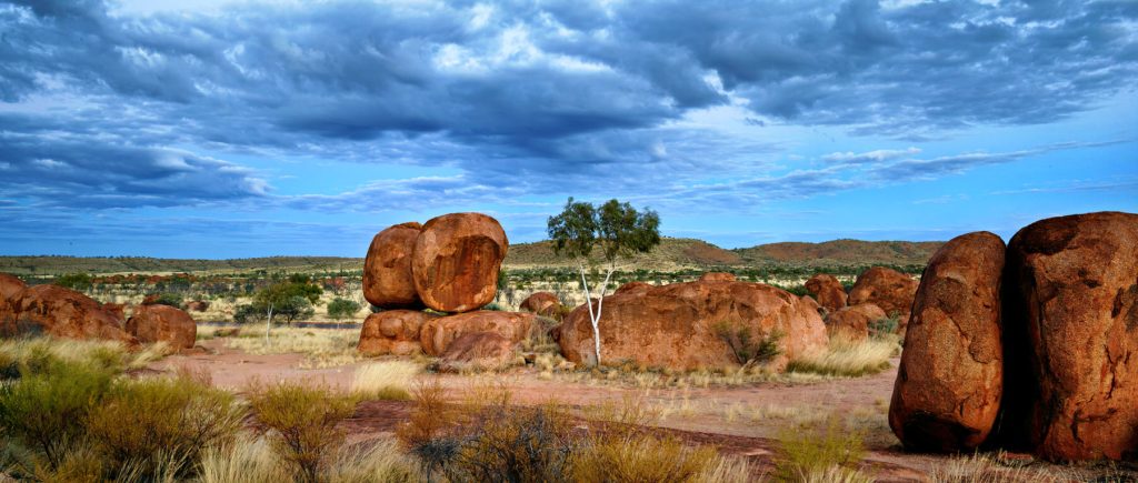
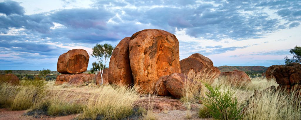
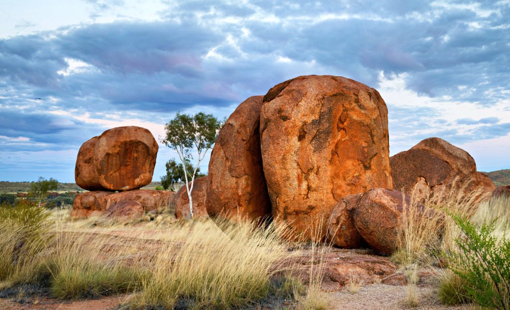
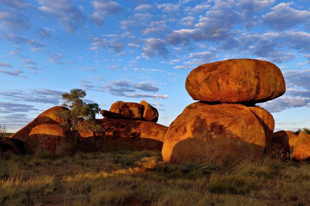
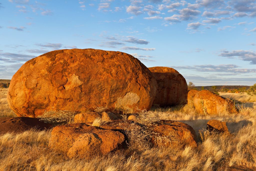
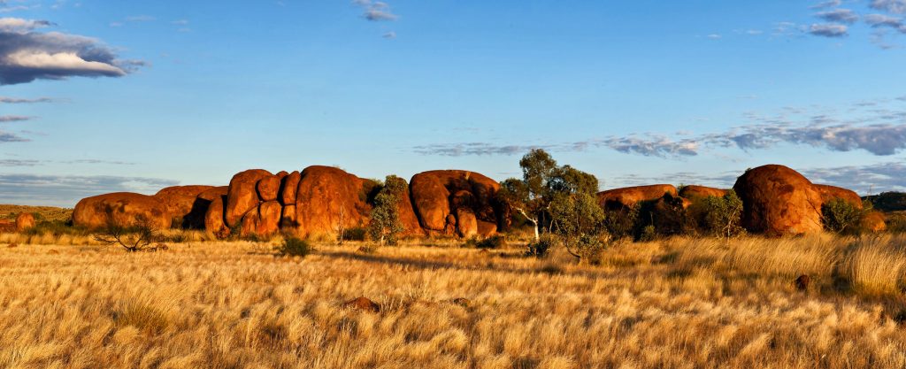
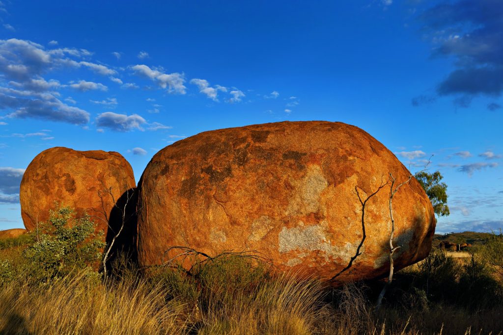
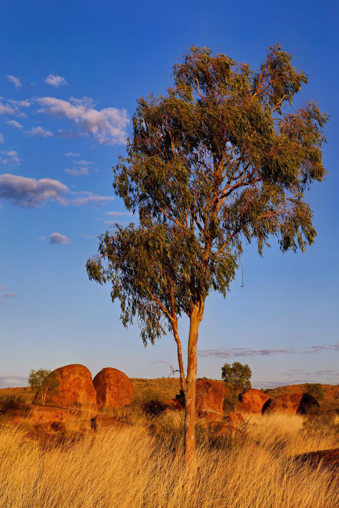
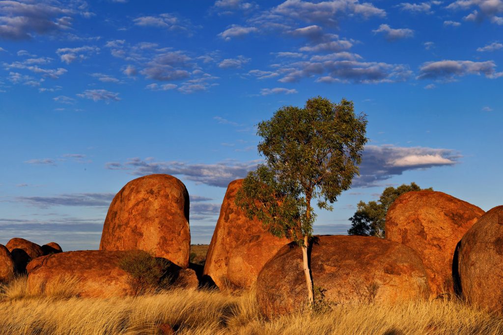
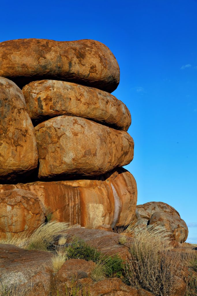
The Doc reprocessed some images from his Northern Territory trip, since he cannot travel due to treatment. This time the Devils Marbles south of Tennant Creek. A few image this time. Click on any image to see the slideshow, enjoy.


You must be logged in to post a comment.