From The Doc’s New South Wales trip in 2014.


From The Doc’s New South Wales trip in 2014.

Part 1 is here, with much of the commentary.
In Part 2 the images are from the surrounding Flinders Ranges, rather than Lake Froome. You get to see the extraordinary variety of rock formations of different colours and textures.
On average the images were taken from 270 to 380 metres in the air. The GPS Datalogger also gives you altitude.
Enjoy, Viva Cristo Rey. Click on an image to see the slideshow of images at full resolution.


When Tony Stott and The Doc went on an adventure to the Flinders Ranges we visited Arkaroola Wilderness Sanctuary. One of the owners Doug Sprigg, loves to fly so we went on a flight over Lake Froome and the Flinders Ranges.

The Flinders Ranges is one of the most geologically unique places in the world. Geologists from all around the globe visit. There is an extraordinary variety of rocks twisted and bent by tectonic forces under the earth. For example, while driving in Brachina Gorge you drove over something like 700 million years of rock layers, that have been bent from the horizontal to the vertical.
One of The Doc’s favorite places to visit. Further south you have Wilpena Pound. Now back to the flight.
Tony had one camera (a Canon 5DII) and The Doc two (Canon 1DX and a Pentax 645Z), We sat on opposite sides of the plane to maximize our opportunities. When processing the images it became clear Tony often had the better side, as The Doc was often photographing into the sun. Together we got a nice mix of images.
Part 1 is below with the flight going out over Lake Froome. Lucky for us the Lake had some water still giving us extraordinary colours and textures. Lake Froome is apparently the whitest salt lake in the world and used by NASA to take various measurements.
Enjoy, Viva Cristo Rey.


Part 2 of the Point & Shoot images from places like Munjina Lookout Road, Albert Tognolini Lookout, Karajini NP Visitor Centre, Warlu Way, Kalamina Gorge Trail, Hamersley Gorge Road, the Roebourne – Wittenoom Road at Chichester, Deep Reach Picnic Area on the Barrimirndi Trail, Panorama Lookout at Roebourne, Python Pool Trail at Millstream, Miliyanha Campground at Kanjenjie, Snappy Gum Drive and the Tom Price-Karratha Road. Lots of panoramas this time around.
How does The Doc know these names years later? All his images have GPS co-ordinates put into them, plus he adds keywords. However another source is using those GPS co-ordinates to Reverse GeoCode the images, this process puts location data into the photo. The Doc just copied some of that information from the images into the blog post.
Viva Cristo Rey.


The Doc also carries around a Point & Shoot camera and these images are from that camera. They are what The Doc calls “explorer images”, but they also have some memorising panorama images.
From places like Juna Downs, Great Northern Highway, Karijini Drive, Joffre Lookout, Kalamina Gorge Waterfall, Kalamina Gorge Lookout and Banjima Road Karijini.
Viva Cristo Rey. Click on image to see full size slideshow.


Reading older blog posts The Doc noticed he has said there are lots of Pilbara images, but had not posted them. That is now remedied, here is a selection. Images from Karijini National Park, it surrounds, Millstream Chichester National Park and surrounding areas. Viva Cristo Rey, enjoy.


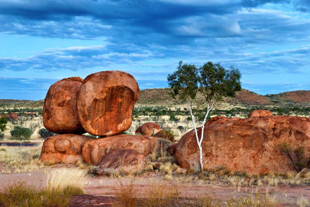
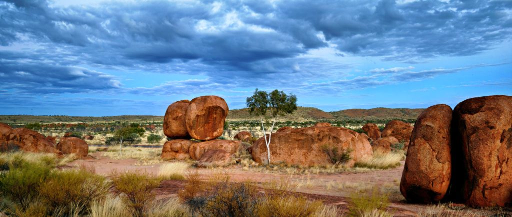
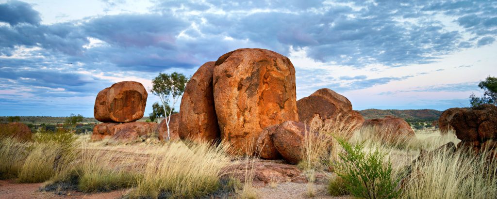
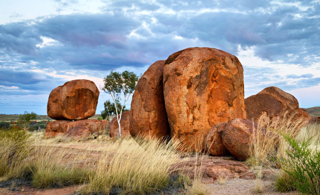
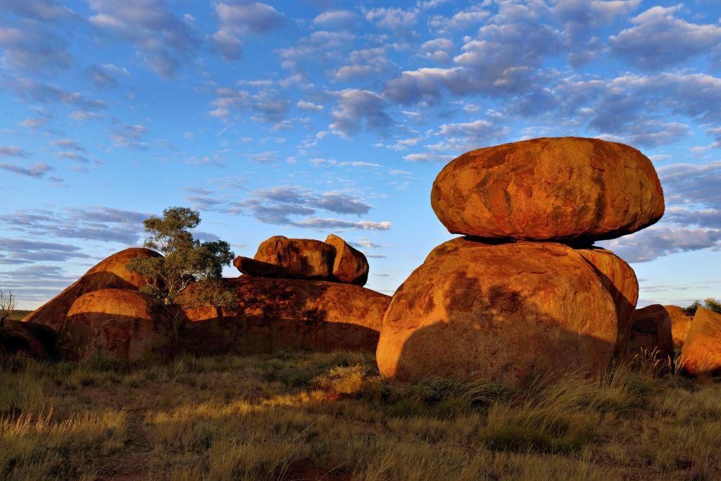
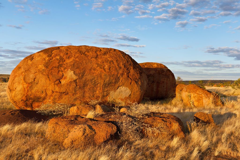
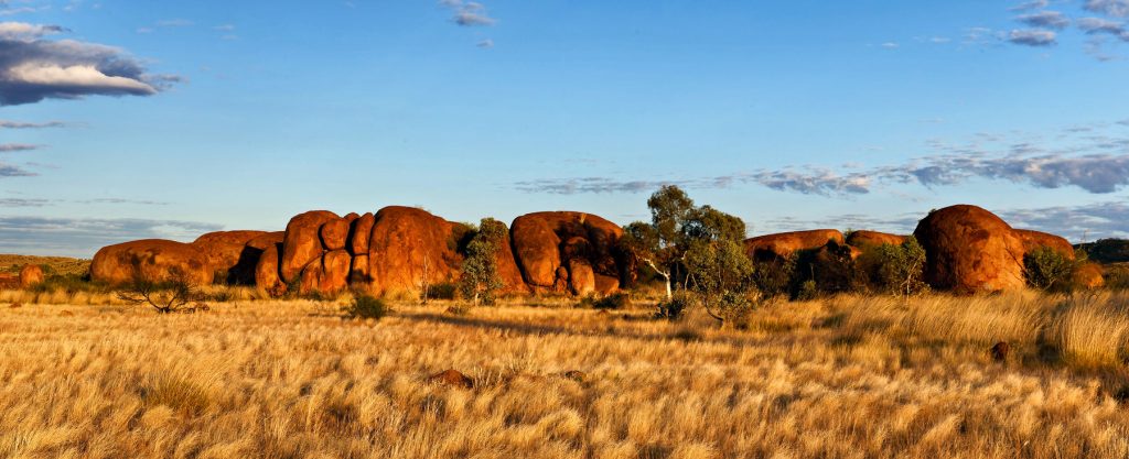
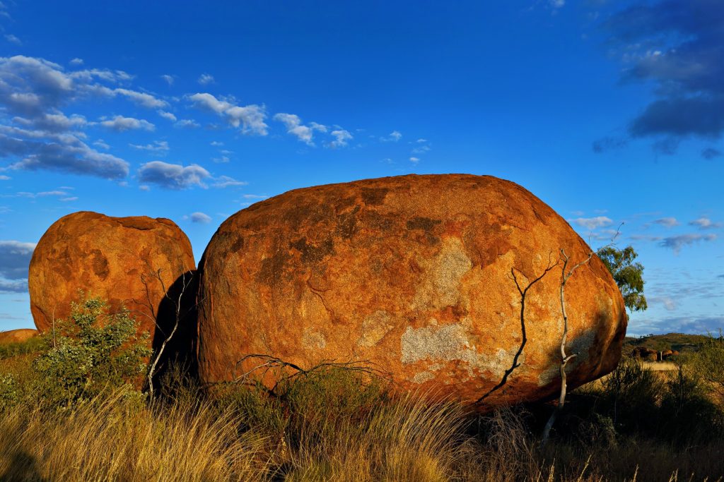
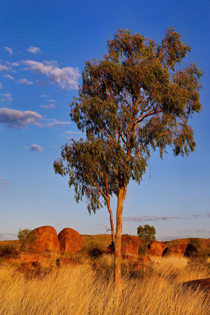
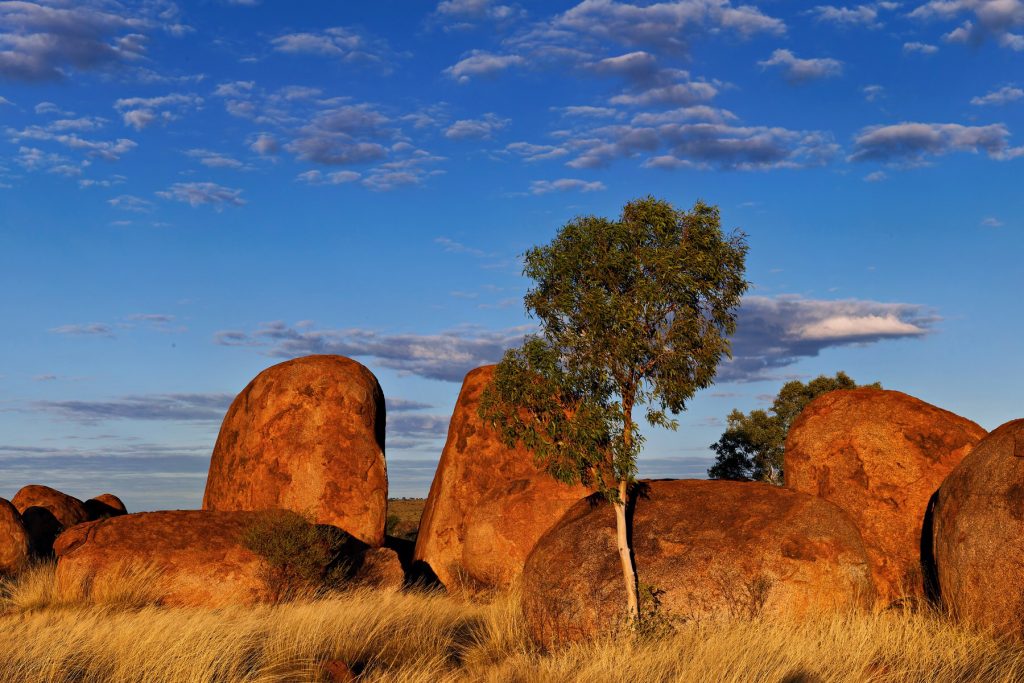
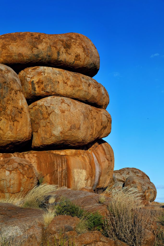
The Doc reprocessed some images from his Northern Territory trip, since he cannot travel due to treatment. This time the Devils Marbles south of Tennant Creek. A few image this time. Click on any image to see the slideshow, enjoy.


The Doc drove straight from Stanthorpe to Eromanga, with an overnight stay at Cunnamulla. The return trip was over a week, starting with an alternate route out of Eromanga. Two nights were spent at St George where The Doc went exploring especially around Dirranbandi, which a mate raves about. Driving down the Castlereagh Highway south out of St George was nice but terrifying anytime a roadtrain came the other way on this narrow road. Dirranbandi is a road hub with heavy roadtrain traffic. Uninspiring so far.
The Doc refueled, took a rest, visited the bakery, and headed back a different way using the Whyenbah Road. A road that services stations and farms. Suddenly the mood changed and became a magical road trip, almost no traffic, beautiful afternoon light, storm clouds and great scenery. The road is not fully sealed, but is slowly being sealed. You rejoin the Balonne Highway just west of the St George Township. The Doc needs to get the exact location of the riverside stop his mate uses and drive on the Whyenbah Road, not the Castlereagh Highway, when heading to Dirranbandi.


Next stop Goondawindi and Boggabilla. There was some local exploring but the main purpose was to visit the Goondawindi Botanic Gardens (Botanic Gardens of the Western Woodlands). A few nights there and then back to Ballina. More time is needed to cover the extensive Botanic Gardens grounds but here are images from the visit:


Most topics are now done. My favourite image of the trip? Peglers Pond at sunrise.


Leaving Eromanga around 4am The Doc headed towards Quilpie; on the western side of Quilpie he turned right onto the Quilpie-Thargomindah Road and headed south towards Toompine. South of Toompine he turned left on the Eulo-Toompine Road and headed towards the Adventure Way and Eulo (he also had morning tea at this road junction). It was a really nice drive along both these roads. The route is on the linked map here. The pictures are from this small part of the trip.
While driving along Eulo-Toompine Road The Doc saw three caravans just off the road, one was being towed by an Eldoret Blue Grenadier (there was no time to stop and talk as there was a long drive ahead). When the Doc reached the corner of the Eulo-Toompine Road and the Adventure Way two large SLRV vehicles (MAN Commanders) were traveling west were talking about the baby SLRV on the UHF (The Doc’s Grenadier). Both events happened in about 30 minutes in the middle of nowhere.
The rest of the trip to Goondiwindi (actually nearby Bogabilla) was the same route as the trip in.
Shakedown lessons
Cunnamulla would be the refueling stop, but the grey nomads were everywhere, especially lined up for fuel. There was still fuel in the Grenadier’s mounted fuel containers. The Doc pulled out the fuel pump to find out the diameter of the tank opening did not let the pump be inserted. The Doc decided to refuel at Bollom instead and arrived on fuel vapors (with one or two litres left in the car).
The fuel tank was fixed at Expedition HQ during the next service, by reboring the opening. It turns out when the tanks were purchased, The Doc was given the wrong set of fuel tanks. This is why The Doc does shake down trips to find things like this out without creating major dramas.
The Doc also found out on the trip he could not sleep in the Grenadier due to his ongoing injuries from the car accident and instead had to stay in a motel. Before setting out The Doc thought he could sleep in the car, but he got a reality check instead! It became obvious on this trip The Doc needed extensive rehab and he started heading back home for treatment. The car was not only being tested but also the driver under field conditions. It was a wake up – and the intense rehab is still ongoing.
The Lightforce Viper lightbar also prove itself in the dark and rain driving out of Eromanga.


After leaving Stanthorpe, The Doc travelled along the Stanthorpe-Texas Road. Then through Texas and heading northward to Inglewood (along the Inglewood-Texas Road), which was a great drive early in the morning. Time to visit the local bakery and get some warm bacon and cheese topped rolls, which was the food for the day (nice rolls they were). The last roll later in the day was warmed up in the Travel Buddy Oven.
The Doc drove all day and stayed overnight at Cunnamulla. It was a long day’s driving. On the way The Doc fueled at a Roadhouse outside Goondawindi. From memory, it was time for a Magnum ice cream.
Leaving Cunnamulla early the next morning The Doc travelled west out of Cunnamulla via Eulo (Eu-lo) and Thargomindah (Thar-go-min-dah) along the Bulloo Developmental Road. Here is an interactive map of the trip from Ballina to Eromanga.
Eulo is a place where many of the Australian Megafauna, like the Diprotodon, are found.
Previously The Doc had always travelled north out of Cunnamulla along the Mitchell Highway, but a change was in order.
The Doc visited Noccundra and then turned northwards onto the Cooper Developmental Road and up into Eromanga the back way.
The traffic was light all the way. It turns out had The Doc gone the normal way (Cunnamulla, Charleville, Quilpie and then Eromanga) he would have run into many cars heading to the Big Red Bash at Birdsville.
On a back road, The Doc came across a little oasis in the in the middle of nowhere in this semi arid landscape. Enjoy.


You must be logged in to post a comment.