Today we fly from Punsand Bay down the west side of Cape York to Weipa.
Enjoy. Viva Cristo Rey.


Today we fly from Punsand Bay down the west side of Cape York to Weipa.
Enjoy. Viva Cristo Rey.
This morning we leave Haggerstone Island, then see downed aircraft, crocs up and close, Captain Billy Goat Waterfall and finally we land near a WW2 wreck of a P39 Aircobra which crashed on its way to Papua New Guinea. Flying up the coast we see bauxite deposits, sands, rivers and finally hover over the tip of Australia. Then an aerial trip around the Torres Strait, we did not land as you can wait for hours before customs turn up (they work on Island time). Last stop Punsand Bay Campgrounds to stay.
Day 2 was as stunning as Day 1 – Revisited here.
Click on an image to a slideshow. Enjoy. Viva Cristo Rey.
Morning


Northern Cape York – eastern side


The Tip and Torres Strait


Punsand Bay after sunset


Leaving from Port Douglas and ending on Haggerstone Island. The original Cape York images and reports are here.

Enjoy. Viva Cristo Rey.


Part 1 is here, with much of the commentary.
In Part 2 the images are from the surrounding Flinders Ranges, rather than Lake Froome. You get to see the extraordinary variety of rock formations of different colours and textures.
On average the images were taken from 270 to 380 metres in the air. The GPS Datalogger also gives you altitude.
Enjoy, Viva Cristo Rey. Click on an image to see the slideshow of images at full resolution.


When Tony Stott and The Doc went on an adventure to the Flinders Ranges we visited Arkaroola Wilderness Sanctuary. One of the owners Doug Sprigg, loves to fly so we went on a flight over Lake Froome and the Flinders Ranges.

The Flinders Ranges is one of the most geologically unique places in the world. Geologists from all around the globe visit. There is an extraordinary variety of rocks twisted and bent by tectonic forces under the earth. For example, while driving in Brachina Gorge you drove over something like 700 million years of rock layers, that have been bent from the horizontal to the vertical.
One of The Doc’s favorite places to visit. Further south you have Wilpena Pound. Now back to the flight.
Tony had one camera (a Canon 5DII) and The Doc two (Canon 1DX and a Pentax 645Z), We sat on opposite sides of the plane to maximize our opportunities. When processing the images it became clear Tony often had the better side, as The Doc was often photographing into the sun. Together we got a nice mix of images.
Part 1 is below with the flight going out over Lake Froome. Lucky for us the Lake had some water still giving us extraordinary colours and textures. Lake Froome is apparently the whitest salt lake in the world and used by NASA to take various measurements.
Enjoy, Viva Cristo Rey.


Part 1 is located here.
Part 2 are images from a Pentax Medium Format camera, were the number of missed shots were lower on this camera than the Canon posted yesterday in Part 1. Every other time it was the reverse.
The Gulf of Carpentaria is an under explored part of Australia. Only this week AWC announced a new species of legless lizard, Lerista munuwajarlu, has been officially accepted after 10 years of the research.
Click on an image to see a slideshow at full size. Viva Cristo Rey.


The hardest lighting conditions The Doc has had on a helicopter trip was at Lorella Springs Station in the Northern Territory. The pilot was Nick, who also took The Doc around Arnhem Land and Kakadu.
There was low light, overcast and the moving helicopter meant many missed shots (blurred due to movement).
Lorella Springs is a working cattle station, and the flight went over the Lost City – one of many using that name in Australia, out to the Roper Region of the Gulf of Carpentaria, following Rosie Creek.
Part 1 was taken with a Canon 1DX camera. Coming in Part 2 are the Pentax Medium Format images. Click on an image to see a slideshow at full size. Viva Cristo Rey.
Part 2 is here.


The massive tidal changes in King Sound reveals extensive mud flats across the southern part of the Sound, around Derby.
Derby township itself is surrounded by mud flats which The Doc drove on several times (being careful not to break through the dried surface). These mud flats are not fully tidal every day, probably only on King tides. However, anytime The Doc felt the surface get soft he headed back to drier parts.
After taking off, in the helicopter, the first place we see is the big house, the Derby Prison. The Prison inmates look after the graves at the nearby Leper Colony, aka the old Bungarun Leprosarium, just north of Derby (Blog report here). The Doc drove up to Bungarun using the mud flats, not the road.
The mud flats reveal one of nature’s fractals, the repeating patterns you see when water is draining away on the mud flats (what The Doc calls the recurring tree pattern). To be precise “Fractals are infinitely complex patterns that are self-similar across different scales.” If you look carefully, you will see the same pattern repeating itself. Admittedly it is more obvious in the helicopter where you better appreciate the scale of these fractals.
There is endless variety in the mud flats, including their shapes, colour and textures. While they are many images, the total was culled hard to give a good cross section.
The Doc finds the mud flats fascinating. Enjoy.


Below is a satellite image of Derby, King Sound (that great big “harbour”) and on its northern edge a group of Islands known as the Buccaneer Archipelago. The Derby mud flats are obvious on the southern edge of King Sound, near the Derby township. Towards the top right is the Walcott Inlet, which leads into Charnley River and its gorge, yesterdays spectacular post.

The helicopter trip continues. Here is small selection of images from the Buccaneer Archipelago. Wikipedia states “The archipelago, covering over 50 square kilometres (19 sq mi) is located at the head of King Sound and is composed of about 800 islands found between King Sound and Collier Bay near Yampi Sound.”
Yampi Sound also has a major Army training base inland from the Sound itself. The images towards the middle with a burn off taking place, from memory, is part of Yampi training grounds. Often Yampi is boring open grasslands. The Australian Wildlife Conservancy helps the Army conserve part of the training grounds set aside for conservation along the coast.
The massive tidal flows are obvious in several images, with the disturbed water during a tidal change.
To see a larger image click on a thumbnail.


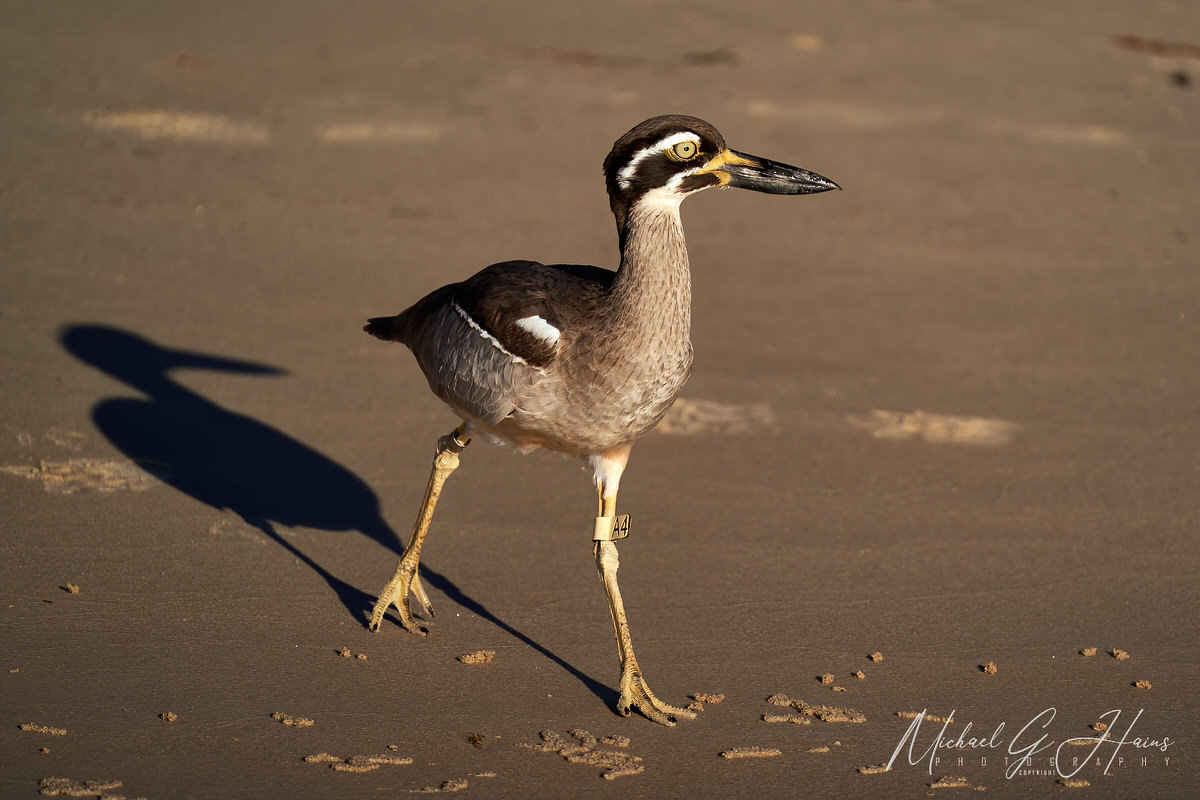
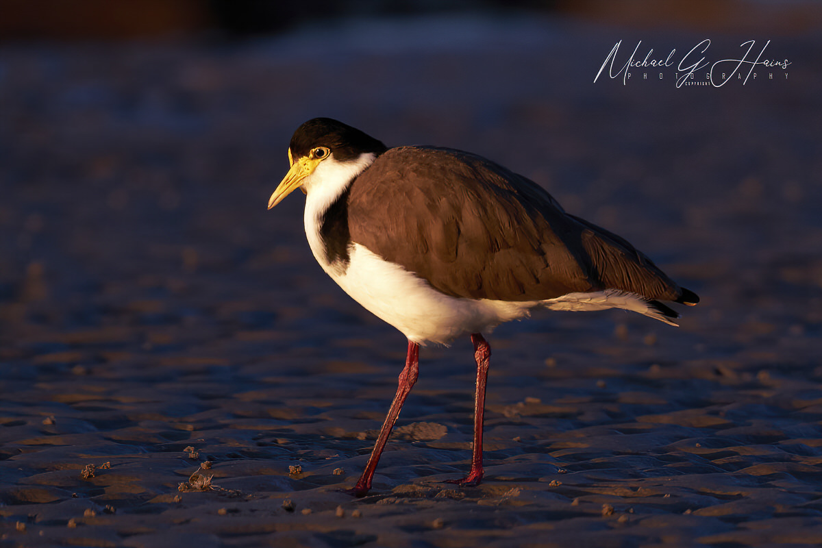
A Beach-stone Curlew and Masked Lapwing.


You must be logged in to post a comment.