Category Archives: Kimberley

The Northern Kimberley

While staying at Drysdale River Station The Doc took a plane flight into the Northern Kimberly. Initially through Prince Regent National Park, then up to Mitchell Falls and back again.

Sorry about the funny colour cast and soft images, it was caused by the window on the plane. The best flight in that area without the high price tag of the helicopter flights at Mitchell Falls itself.

The Bungle Bungles, Kimberley, WA

The Bungle Bungle Ranges in the Purnululu National Park (The Kimberley) has the most extensive beehive rock formations in the world. While well known to local Aboriginals and Cattle Station owners, it did not become known to the world until the early 1980s.

Within 5 years it was a National Park and within 20 years it was World Heritage listed.

The beehives are formed by wind driven sand and rainfall (plus millions of years of weathering).

The beehive domes consist of different layers of sandstone; some orange, some black. The black layers hold more moisture allowing cyanobacteria growth which cause the black colour. The orange-coloured layers are stained with iron and manganese mineral deposits within the sandstone (in lay terms – rust!).

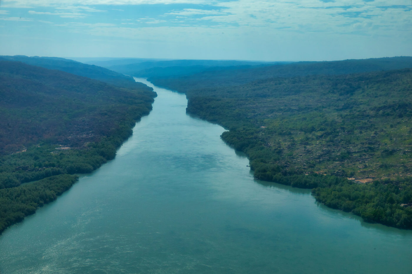
Typically, you see the domes from ground level. The Doc took a helicopter flight over The Bungle Bungles. The images are split into two groups; first, the rock formations out of which the beehives are weathered. Here you see deep gorges, meandering rivers (floodways now) and steep gorge walls. Second the domes or beehives themselves, from the air. Make sure you click on the pictures to see the full size images.

The Doc has been posting fewer images lately, but the Bungles deserves more to appreciate its stunning beauty.

Crimson finch – blacked belly

The Doc could not travel to the Kimberly this year, so he is visiting images from his last trip in 2015. Here are the Crimson finch, the black bellied subspecies. Click on image to see full size.

Bell Gorge – Gibb River Road, The Kimberley, Western Australia

One of the iconic destinations on the Gibb River Road in The Kimberley is Bell Gorge. The Doc will let the pictures do the talking. Remember to click on the image to see the full size (the thumbnails are blurry). Enjoy.

Mornington panoramas and sunsets – The Kimberley

When The Doc visited Mornington Wilderness Camp he took quite a few panoramas of Sir John Gorge, Fitzroy Bluff and also some sunsets. He has now stitched many of those together. Enjoy (remember to click on thumbnails to see full size.)

Sunsets

Australian Wildlife Conservancy Images indexed – huge sigh!!!!!

The Doc has finally finished indexing 300,000 odd AWC photographs. The photographs have been sent back to the AWC head office. It will take a week or 2 to copy across the files and get them into the Daminion catalogue. It has been a huge undertaking – The Doc started in late Janaury.

The Doc would love to show you some of the images, but you’ll need to settle for his images, from AWC Sanctuaries. Enjoy.


AWC’s Artesian Range – Charnley River Sanctuary

Still thinking about last years trip to the Kimberley. This time Charnley River which also contains the majestic Artesian Range. Report and photos here.

AWC’s Mornington Sanctuary

We are coming up to May 1st when the Mornington Wilderness Camp reopens. This time last year The Doc was driving to The Kimberley. Report and photos from The Doc’s first trip to Mornington here.